15. June 2022

Geophysical measurements on the North Sea island Spiekeroog Geophysical measurements on the North Sea island Spiekeroog

In May 2022, the Geophysics Section conducted a field trip of several days to the North Sea island of Spiekeroog, as part of the course Hydrogeophysics in the Master's degree program in Physics of the Earth and Atmosphere.


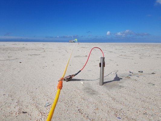
Electrode, profile and sand
Electrode, profile and sand - ERT profile (Geoelectrical Resistance Tomography) Steel electrode in beach sand © Andreas Kemna / Geophysics Section / Uni Bonn
Download all images in original size The impression in connection with the service is free, while the image specified author is mentioned.

In May 2022, the Geophysics Section conducted a field trip of several days to the North Sea island of Spiekeroog, as part of the course Hydrogeophysics in the Master's degree program in Physics of the Earth and Atmosphere. Spiekeroog is located off the North Sea coast of Lower Saxony, can be reached by ferry from the coastal town of Neuharlingersiel, and is part of the Wadden Sea National Park. The students learned the practical use of geophysical methods, e.g. electrical resistivity tomography (ERT) and ground penetrating radar (GPR), by investigating the freshwater-saltwater interfaces of the island’s groundwater and its tidal dynamics.

Interested?
ERT at sunset
ERT at sunset - ERT measurement on the beach at sunset © Andreas Kemna / Geophysics Section / Uni Bonn
ERT profile structure in the direction of the coastline
ERT profile structure in the direction of the coastline © Andreas Kemna / Geophysics Section / Uni Bonn
GPS and GPR
GPS and GPR - GPS and GPR (Ground Penetrating Radar) measurements on the coastline © Andreas Kemna / Abteilung Geophysik / Uni Bonn
Wird geladen